FRCRockwall13

Scenic Drive

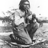
All Day Scenic Drive

FRCRockwall13

Feather River Canyon National Scenic Byway

This scenic drive begins at the Gateway to the Feather River Canyon National

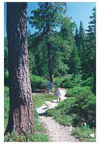
Scenic Byway in Oroville and goes past Beldon Town, a hikers stop on the Pacific Crest Trail, on to Quincy.

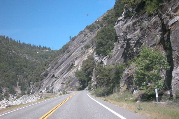
Dedicated in October, 1998, this drive offers spectacular views of the Feather River Canyon. With much of it carved out of solid granite and rock cliffs and completed in 1935, the Feather River highway features miles of roadway that crisscross the north fork of the Feather River and several tributary streams as it winds through Plumas National Forest.

Hwy. 70 North fork

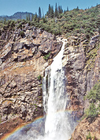
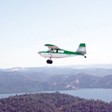
A spectacular drive for scenery during any season, we especially enjoy it in Spring with nearly 100 waterfalls flowing and 1000s of wildflowers and in the Fall for Autumn color.

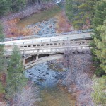
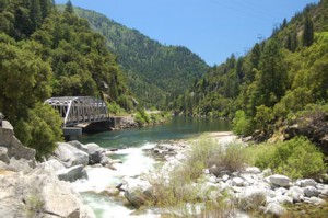
The steel arch bridge located about 30 miles north of Oroville is one of the wonders of construction on this breathtaking drive. The 680 foot long structure is 200 feet above the river and 170 feet above the Western Pacific Railroad bridge below. The bridge is unique in that it not only curves as it crosses the river, but is also banked, creating a span that both curves and twists at about a five-degree angle.

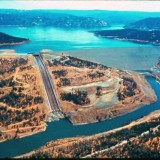
Along the drive, you’ll see several PG&E hydroelectric facilities, and will travel through three tunnels; the third and longest is 1,187 feet and has viewing windows on the north side. The tunnels were a WPA project, with some of the rock removed from inside the tunnels used in the stone guardrails seen throughout the drive.

Also, of note if you’re interested in rock climbing is Grizzly Dome, where folks scale the vertical rock, near one of the tunnels.

Bucks-Lk

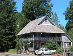
In Quincy we’ll stop for lunch at Morning Thunder, 557 Lawrence St. This is also a great place for breakfast. After lunch back on Hwy. 70 and quickly left onto Bucks Lake Road where more vistas provide great views on the way through Meadow Valley as we continue west to Bucks Lake.

DSC_0020

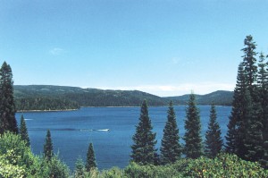
Since you’re looking for scenery a side trip well worth your time is Silver Lake. Watch for the road about eight and a half miles out of Quincy. Silver Lake Road will be on your right and will be a 15 minute drive.

MountainHouse08

On the way past Bucks Lake you may want to take a break at either Lake shore Resort or Bucks Lake Lodge both of which you’ll pass by. Then it’s on down the winding and beautiful drive to our starting point and final destination, Oroville. Bucks Lake road turns into Oro-Quincy Highway at Mountain House. The old Hotel and stage coach stop was a hangout for the notorious robber Black Bart.

Hiking

Foothills Hikes

Hiking

Hike & Climb

Table Mountain

Table Mtn. Blvd. to Cherokee Rd., to the mountaintop

If you haven’t been to the top of Table Mountain in the Spring, you’ve missed a sight that folks travel from afar to view–the wildflowers in bloom.
You’ll see them in multiple sizes and many shades of yellow, pink, and white along with the striking bluish-purple lupines and brilliant golden poppies. You may also see people flying kites.

If you park your car and hike, please walk only in designated areas. For the very hearty, there are many hidden surprises, including beautiful waterfalls.
For a guide to recognizing and learning about the wildflowers, buy a copy of Wildflowers of Table Mountain – Butte County, California by Samantha Mackey and Albin Bills, illustrated by Larry Jansen. The book can be found in some Chamber of Commerce offices or by ordering from: Biological Sciences Herbarium, CSU, Chico, CA, 95929-0515 or call 530-898-5381.

Feather-Falls

Feather Falls

Plumas National Forest • 530-534-6500

Olive Hwy. east to Forbestown Rd., north on Lumpkin Rd.

To view this magnificent 640 foot waterfall, you’ll need about four hours of time since it’s a seven-mile, round-trip hike, but we bet you’ll remember the breathtaking view for months to come. Markers appear every half mile to show distance traveled, and hikers are cautioned to take along plenty of drinking water and to wear adequate footwear for the hike.

There are two trails—a moderate and a strenuous one. Both feature magnificent scenery. Many enjoy taking a picnic lunch to enjoy leisurely.Be cautioned that on the strenuous trail, the last mile on the way back to the trailhead is uphill, so allow plenty of time to complete the hike before dark.

Bald Rock

Plumas National Forest 530-534-6500

Hwy. 162 North to Berry Creek, right on Bald Rock Rd. Turn left downhill into well-signed parking area

It’s only a quarter-mile hike from the parking area to the huge Bald Rock formations. The spectacular view of the Sacramento Valley and coastal ranges make it a hike worth taking.

There are many unique formations atop Bald Rock, and outstanding views in every direction. The Maidu have a legend of a monster called Uino who protects the middle fork of the Feather River from his dwelling atop Bald Rock. We commend his choice of vistas.

4 Wheel Adventure

Poker Flat

Near La Porte, CA. Start at County Rd. 512 and carefully follow your dirtections to La Porte, St. Louis Bridge, Howland Flat & Poker Flat. 4-wheel drive only.

Poker Flat had its beginnings in the early 1850’s. It is reported that only 12 families were living in the camp by 1856, but 400 miners lived within two miles. Henry Cohn, who had a store there from 1857 to 1863, described Poker Flat as a “miserable hole.”

Today Poker Flat is a beautiful setting on Canyon Creek with artifacts from the 1800’s still visable. Goldmining claims are still active. Though not too far from La Porte, it is strictly a 4-wheel drive trip. But, when you get there you can camp at six campsites constructed by the U.S. Forest Service complete with picnic tables and fire pits. The toilet facilities are basic.

It’s an easy and picturesque drive from Oroville to La Porte via the Forbestown Road. Leave Oroville on Hwy. 162, also Oroville-Quincy Road. About six miles east of town, Forbestown Road goes off to the right and it’s about 14 miles to Forbestown. At Forbestown the name of the road changes to Challenge cut Off Road and leads to La Porte Rd. At that intersection, you will take a hard left and go through Challenge, CA. Stay on the La Porte Road which eventually changes to the Quincy La Porte Road and tang you onto La Porte.

Here you can stop for provisions if necessary and just north of town is a warming station and public restrooms. A short 1/4 mile further on the right is St. Louis Rd. Take it east bearing right and leading to the St. Louis Bridge. Immediately after the bridge turn right. A mile or so along, the Port Wine Ridge Road will intersect from the right and the name of the road changes to Port Wine Ridge Rd. Contine on to Howland Flat an abandon old mining town where you can still the the ruins of the Wells Fargo Office. Here the name of the road changes to Poker Flat Road and will lead you to Poker Flat.

You’ll see the 4-wheel drive sign at the top of the ridge leading down to the former mining village at Poker Flat on Canyon Creek. Best to plan on camping overnight.

Then you can cross the creek and continue up the mountain on Saddleback Road bearing left onto Eureka Mine Rd. and to hwy. 25 and on to hwy. 49.